 |
The ERS satellitesERS-1 |
 |

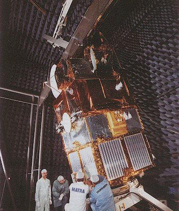
On 17 July 1991, the European Remote-Sensing Satellite, ERS-1, the first European satellite to carry a radar altimeter, was launched into an 800 kilometer altitude and 98.5 deg inclination orbit. During the first few months, the Commissioning Phase, all instruments were calibrated and validated. Since then ERS-1 has been flying two Ice Phases (in which the repeat period was 3 days), a Multi-Disciplinary Phase (a 35-day repeat orbit lasting from April 1992 till December 1994), and the Geodetic Phase, which started in April 1994 and has a repeat period of 168-days. The second repeat cycle in this Phase, currently on-going till the launch of ERS-2, was shifted by 8 km with respect to the first so a ``336-day repeat'' is obtained.
Since launch the satellite has monitored the sea surface almost continuously. The accuracy of its altimeter range measurements has been estimated to be a little under 5 cm.
Related Issues
 |
The ERS Satellites: Introduction General introduction on ERS and lots of links to local and external related information. |
 |
The ERS Satellites: Instruments More information about the wide range of instruments carried by the ERS satellites. |
 |
European ERS Mission ERS-1 and ERS-2 mission news, information, and images. |
 |
Earthnet Online The ESA/ESRIN Multimission Remote Sensing Server. |
 This page is maintained by